This post was updated, June 20, 2023.
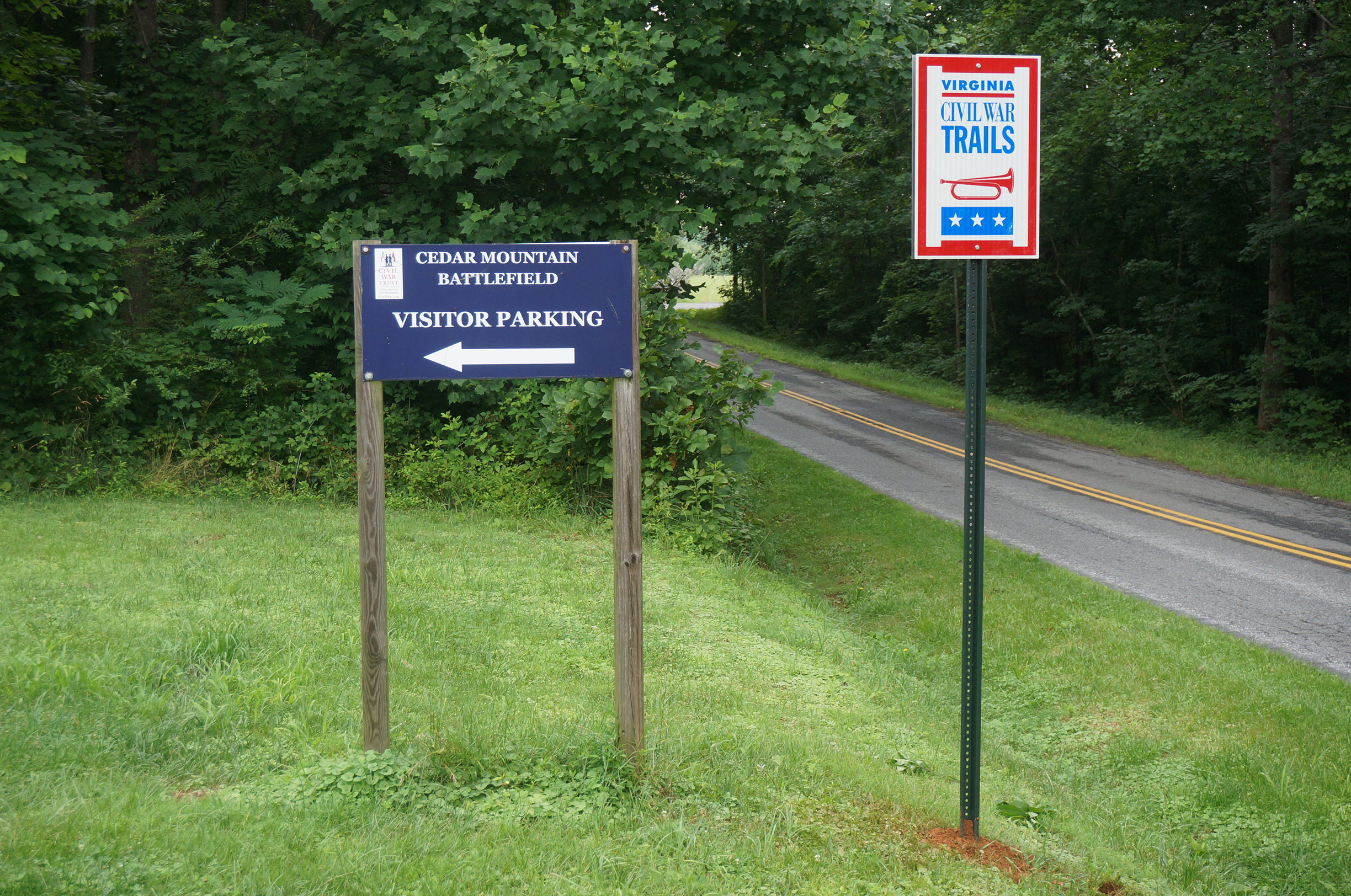
There are eleven historical interpretive markers on the battlefield for visitors who would like to take a self-guided tour. There is no better way to gain understanding of a battle than to walk the ground. We hope this article will be useful to individuals or groups planning a visit.
When the American Battlefield Trust (ABT) first acquired the property now preserved, representatives met with the Friends of Cedar Mountain Battlefield (FCMB) to discuss trail options. The trails were laid out to make use of the preserved parcels while also keeping the land farmable. Trails had to be safe and easy to maintain.
ABT staffers Gary Adelman and Sam Smith laid out the trail plan and sign options. Alterations were made with input from FCMB board members, including Lon Lacey, Michael Block, Diane Logan & others. The same process occurred to create the content for the battlefield interpretive markers. The ABT wrote the first drafts, which were improved upon FCMB. The revised comments were reviewed by three outside historians, Greg Mertz, Bob Krick Sr. and Bud Hall. These comments were incorporated into the overall content.
The maps were created by Steve Stanly specifically for these interpretive signs. The installations happened around the start of 2016.
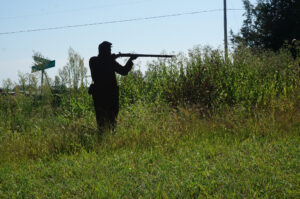
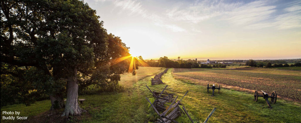
The Trust was looking to try some new things for interpretation and settled on the silhouettes at Cedar Mountain. In what proved serendipitous, the infantry silhouettes’ placement gives an accurate approximation of the farthest advance of General John White Geary’s Ohio Brigade.
The signs were updated in 2022.
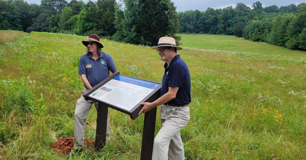
On June 27, 2022 the American Battlefield Trust and Civil War Trails, working with the Friends of Cedar Mountain Battlefield, installed 11 new wayside markers on the Cedar Mountain Battlefield.
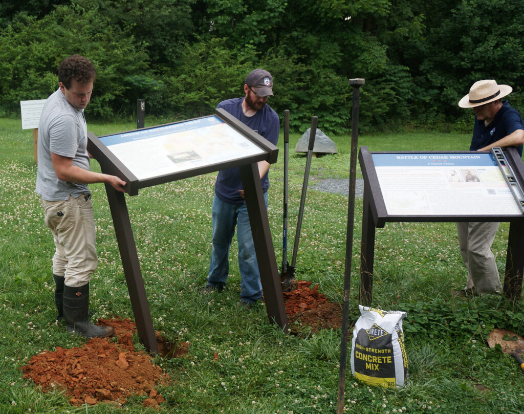
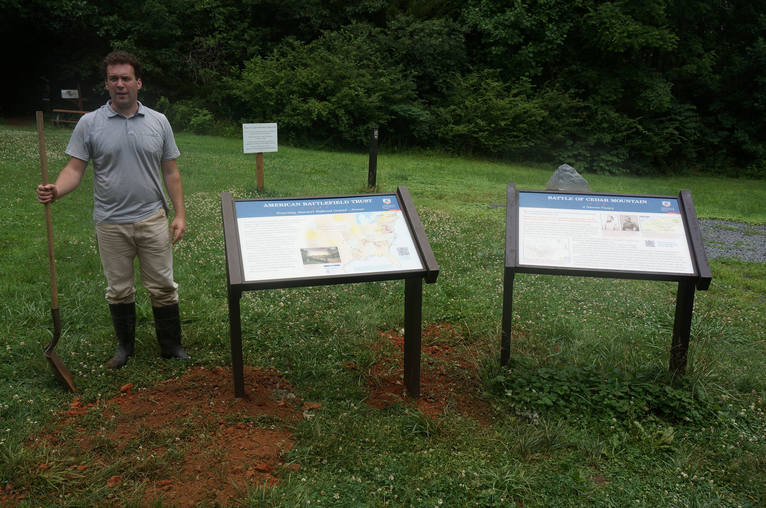
Picture: Drew Gruber and Dan Davis, install the a new wayside marker at battlefield parking area. Historian Michael Block looks on.
Our grateful thanks go out to Dan Davis, Senior Education Director of the American Battlefield Trust, Drew Gruber, Executive Director and Chris Brown, Assistant Director of Civil War Trails, and Paige Reed, Director of Economic Development and Tourism for Culpeper. It was this partnership and support that made the new waysides possible.
Seven of the original signs are updated. They replace signage on the battlefield which have served visitors from around the world for over a decade. Two new signs, “Terror in the Woods” and, “The Brushy Field” add to the dramatic interpretation. All the waysides include maps, quotes from battle participants and photos that pertain to that portion of the battle. These new signs will allow visitors to understand the fighting on these portions of the battlefield that had gone without interpretation. The text and images have been revised, by battlefield historians Michael Block and Bradley Forbush. The new and revised signs are placed closer to where the events they describe happened, offering a more engaging text and media to help fuel the imagination of visitors as they stand on ground where the historic events took place on the battlefield. Each of the waysides has a map which has been revised to reflect the terrain of 1862 as well as locations of the contending armies on that portion of the battlefield. The revisions were vetted and approved by ABT.
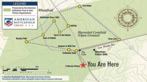 The Trail Map is not yet updated. This graphic will suffice for reference. (Although the marker descriptions below are numbered, it is not necessary to follow the trail stops as numbered, though it might be helpful with the interpretation. The revised marker positions reflect what happened during the battle in the general area where they are placed.)
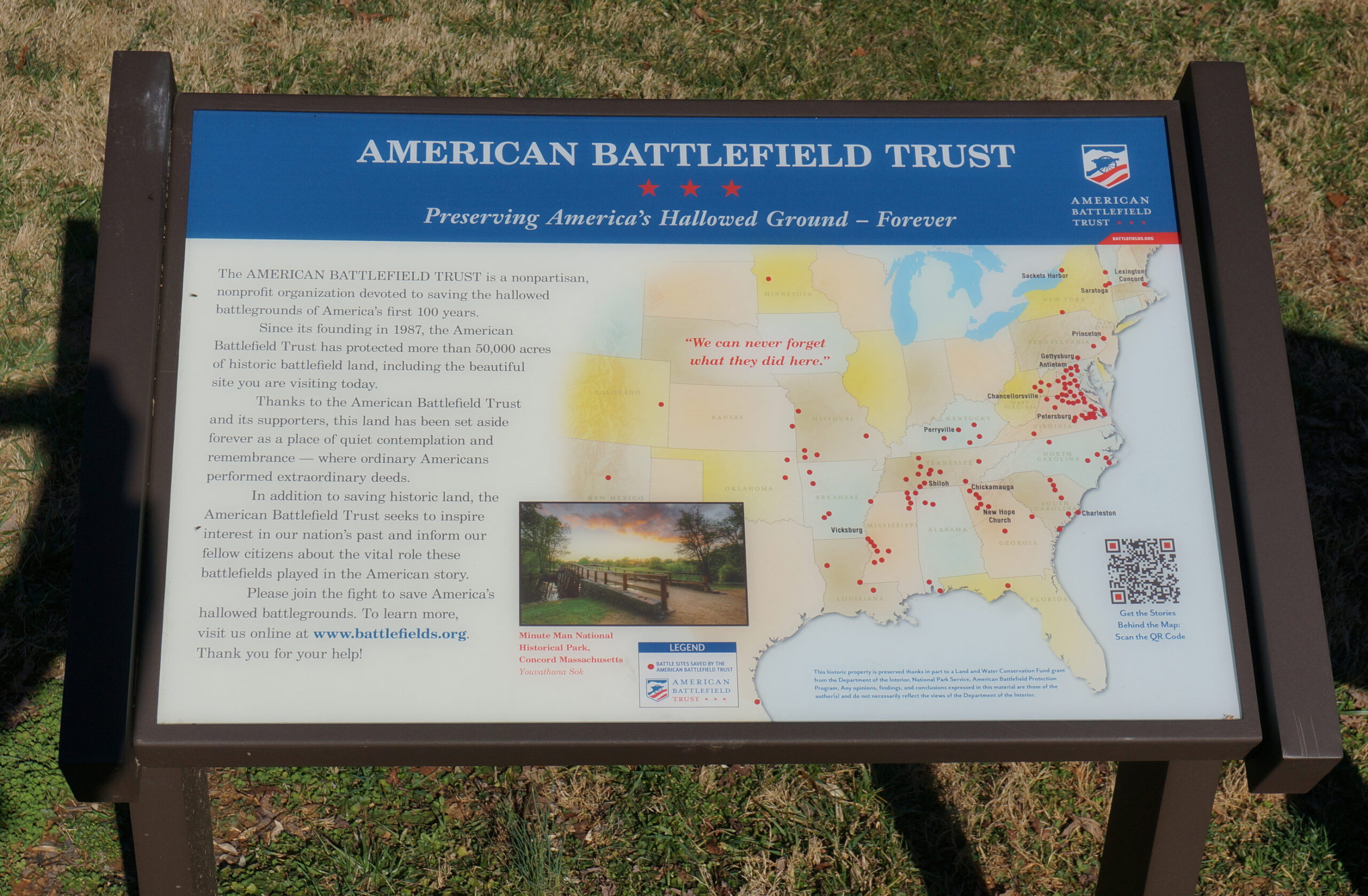
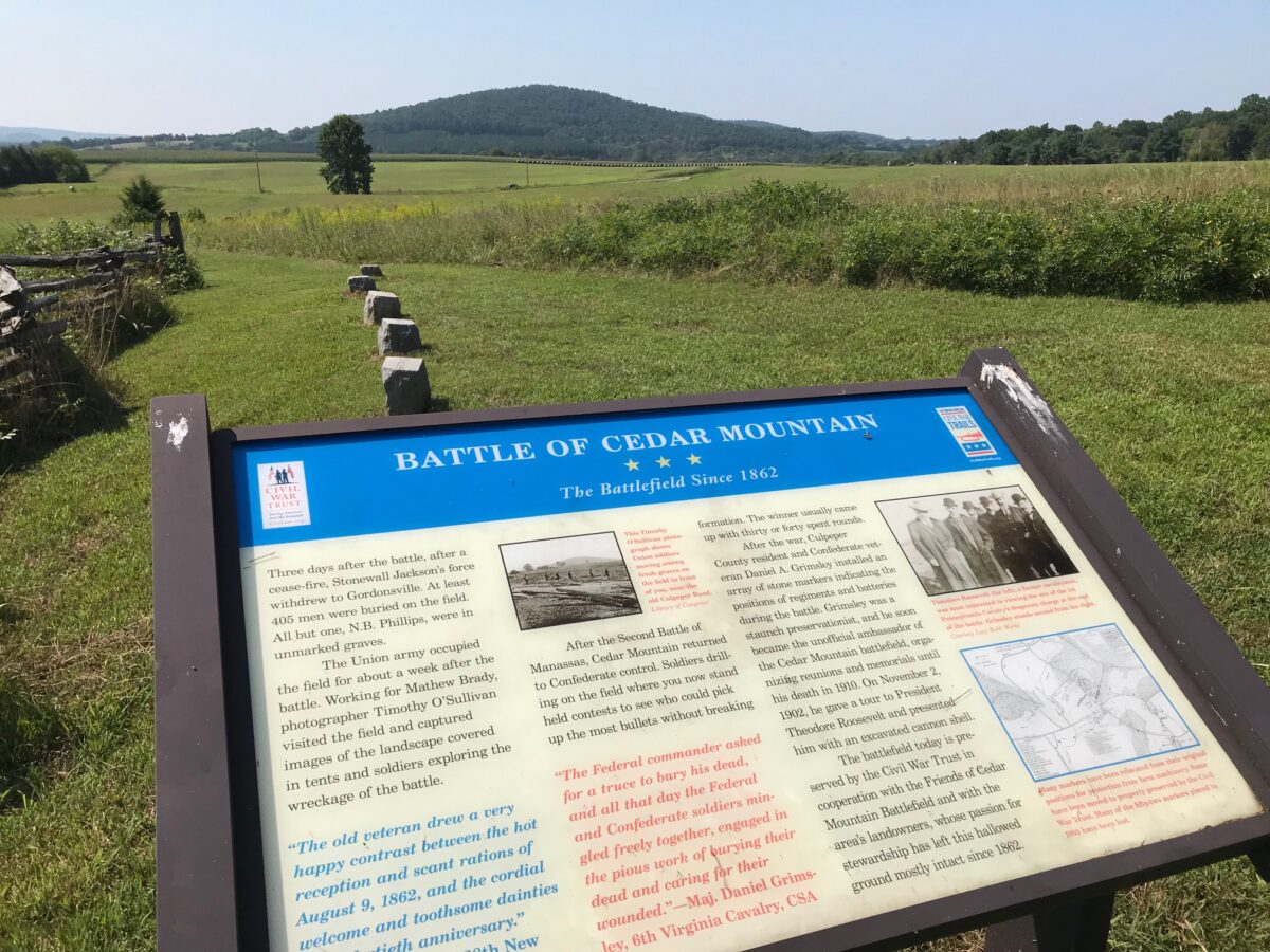
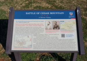
The first new sign honors the preservation efforts and achievements of the American Battlefield Trust in saving the hallowed battlegrounds of America’s first 100 years. It is placed at the parking area where the trails begin, beside the first of the battlefield interpretive markers titled, “A Narrow Victory.” (see first photo at left of first paragraph).
The second marker, #2 on the trail map, is appropriately placed at the Crittenden Gate. What confuses many who try to interpret the battle is that the original road that was the axis of the battle continues straight along the fencing from this point forward. Modern day General Winder Road was the Crittenden Lane and Highway 15 did not exist.
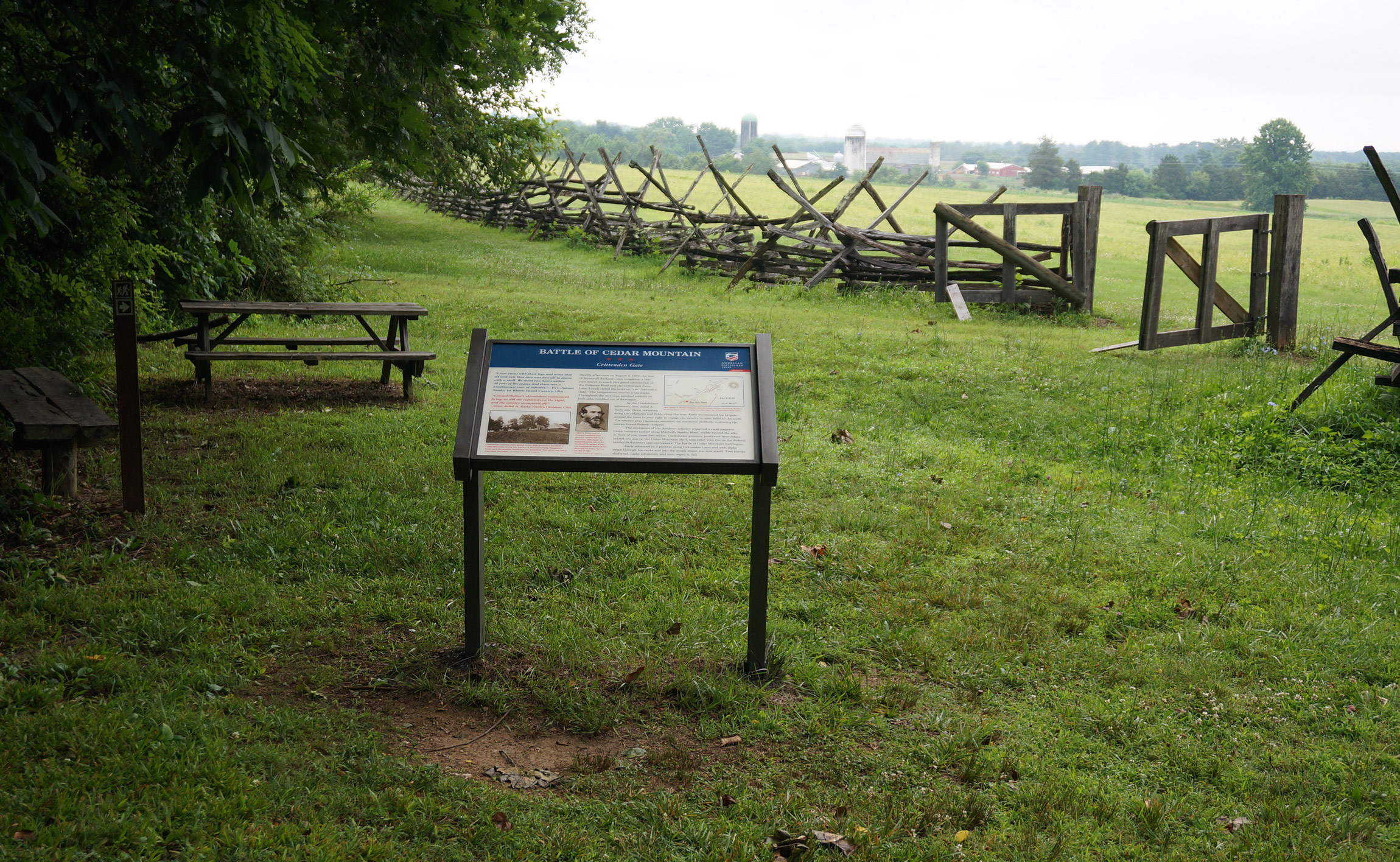
The historic Crittenden Gate was restored by members of Boy Scouts of America Troop 225 under supervision of FCMB Board Member Sam Pruett.
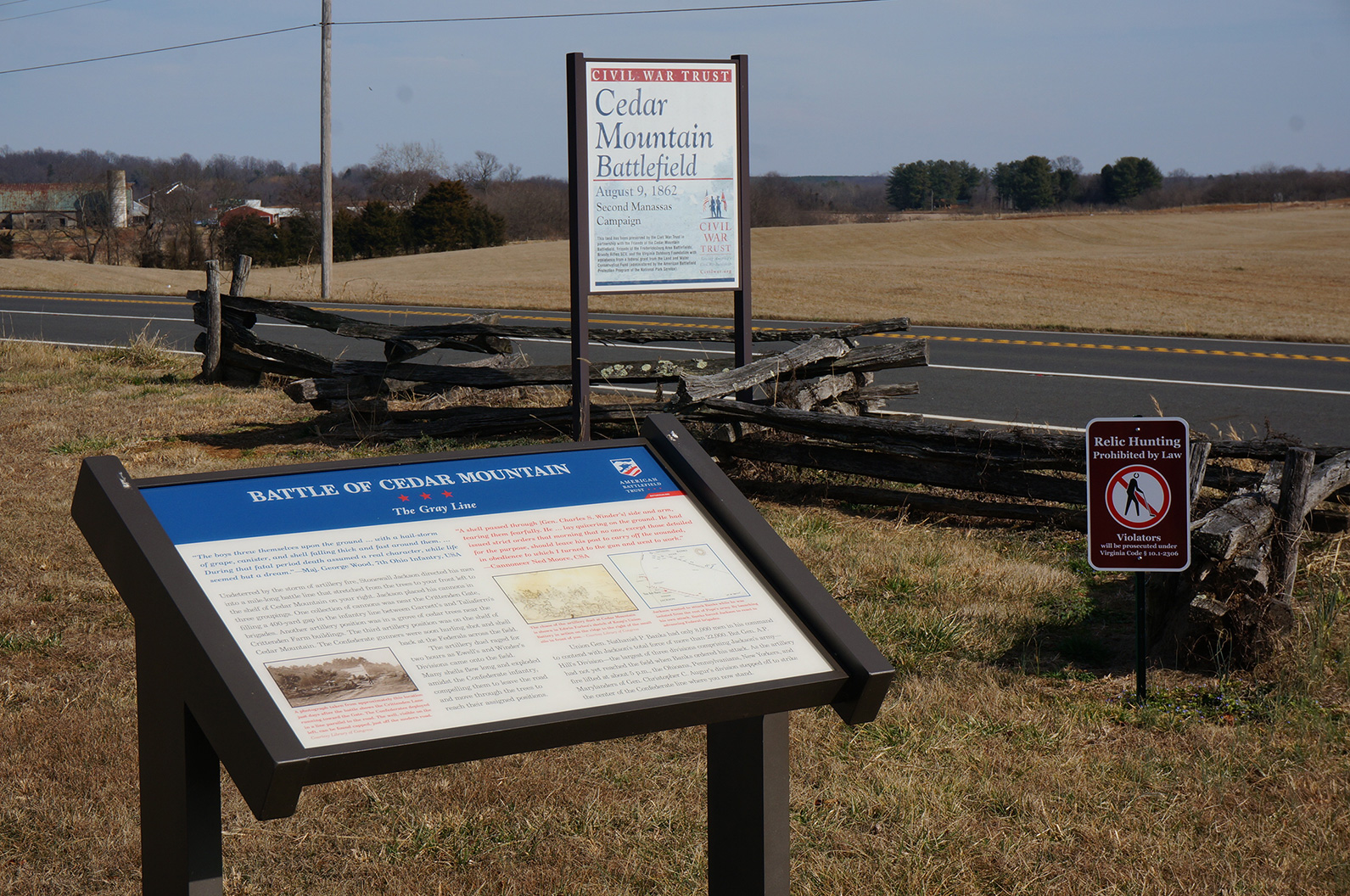
The third marker is titled “The Gray Line” and is placed approximately where William B. Taliaffero’s Brigade came into line.

Marker #4 is titled “The First Blow.” It represents the launch of Union Brigadier-General Christopher C. Auger’s Division attack upon the Confederate line. The trail from marker #3 to #4 parallels highway 15. On hot days the trail is in full sun with little relief, whereas the other markers are close to shade.
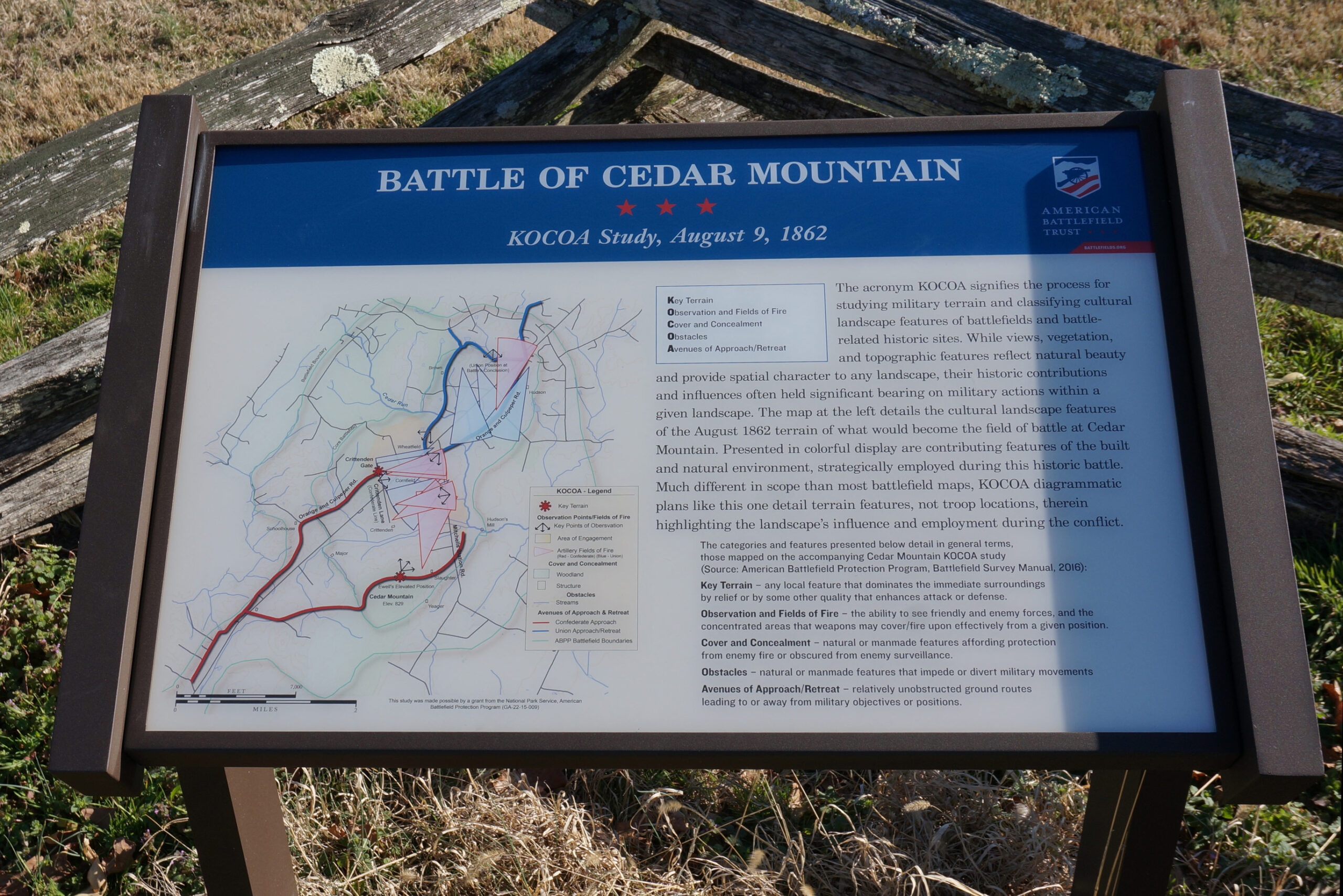
Another new battlefield marker added to the trail, creates a new stop. The marker, titled, “KOCOA” interprets the battlefield terrain from a military perspective. The acronym KOCOA stands for, Key Terrain, Observation Points and Fields of Fire, Cover and Concealment, Obstacles and Avenues of Approach/Retreat.
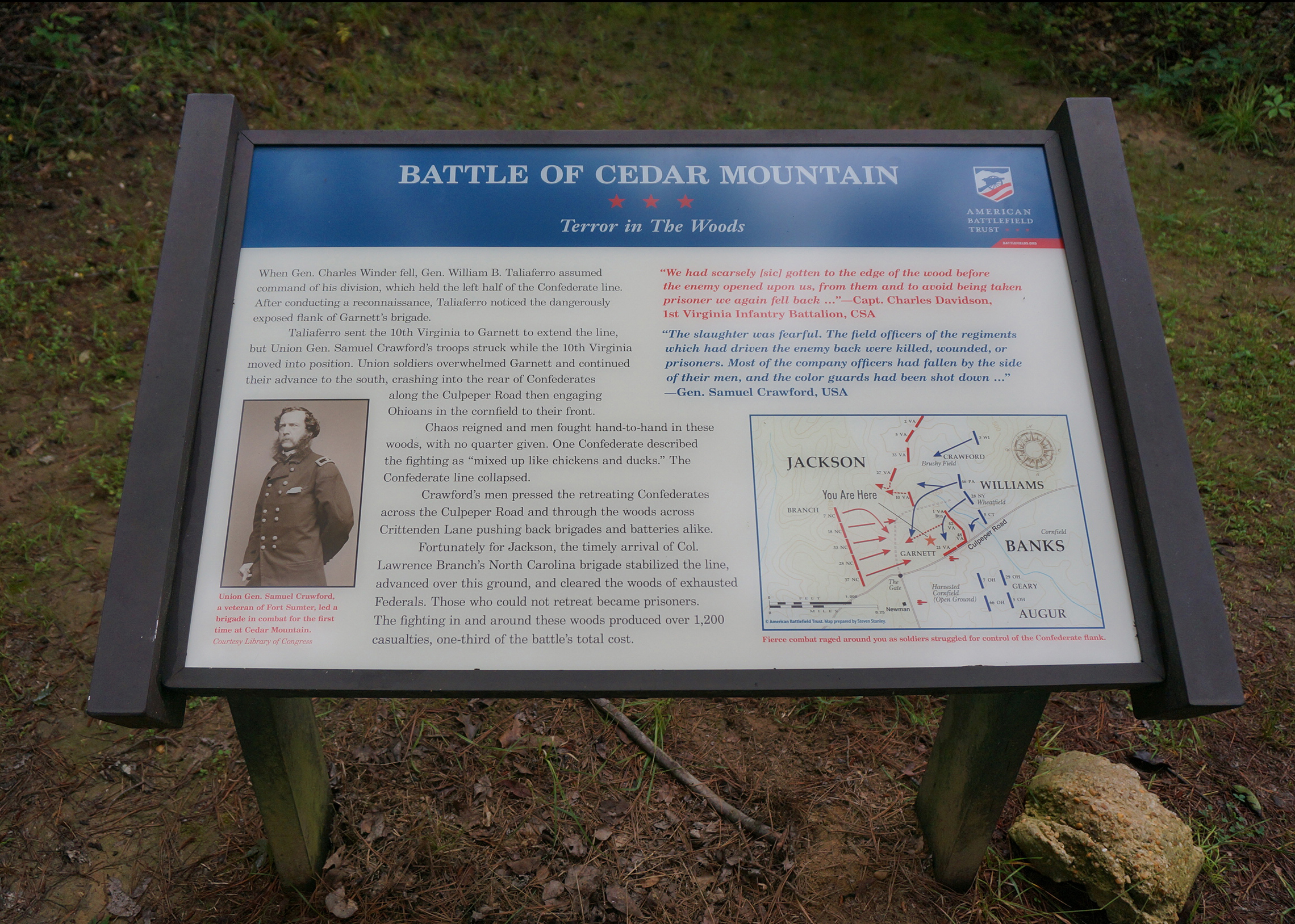
In a stand of woods along the trail, where the “Stonewall is with you!” marker was formerly placed, there is a new marker titled, “Terror in the Woods.” This new marker more accurately reflects the hand to hand fighting that occurred here, as 3 regiments of Brigadier-General Samuel Crawford’s Union Brigade battled it out with the regiments of Lt-Col. Thomas Garnett’s Confederate Brigade. (The “Stonewall” marker has been moved to a Trail Stop location near the Crittenden Gate, much closer to where it actually happened.)
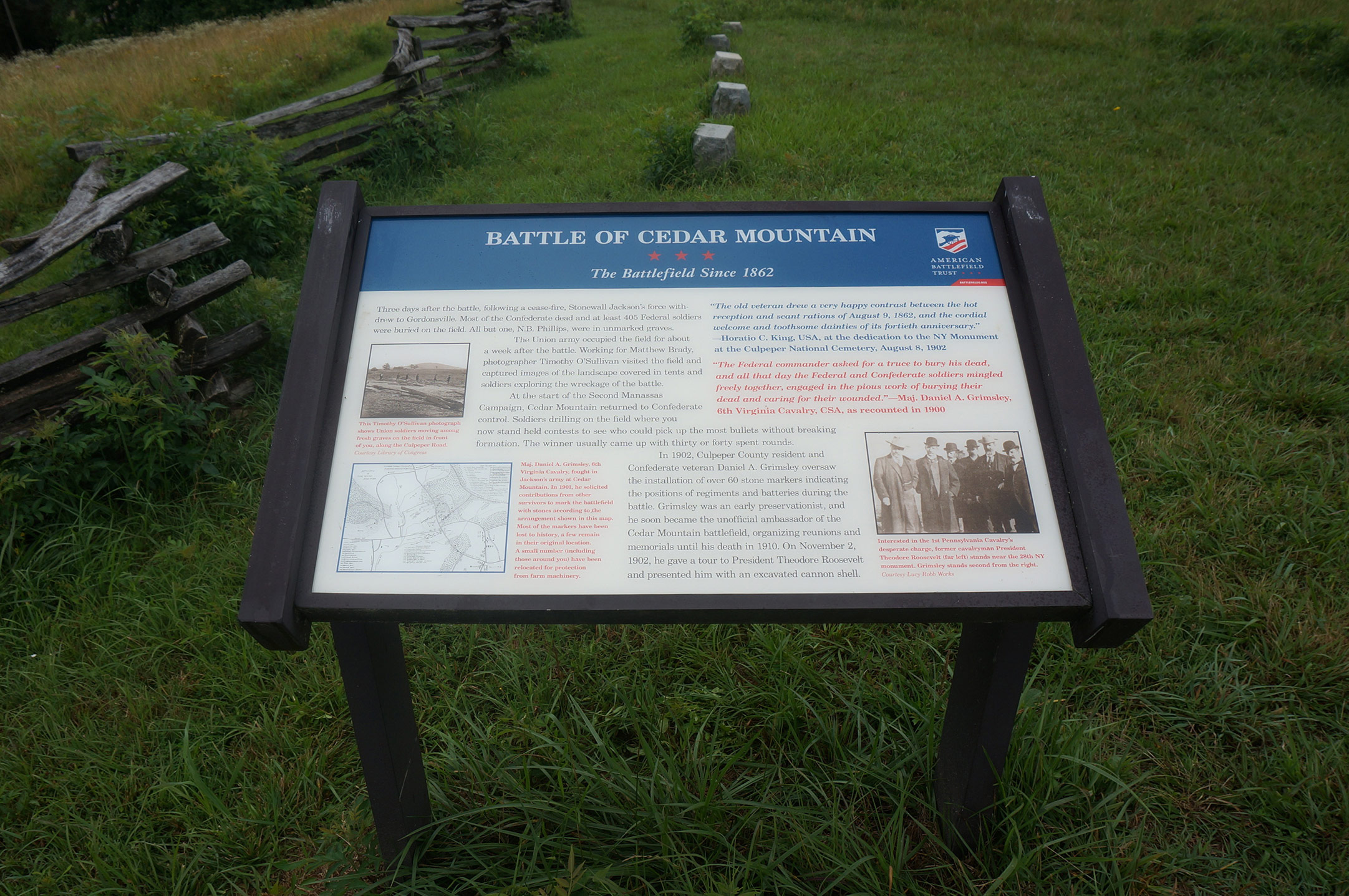
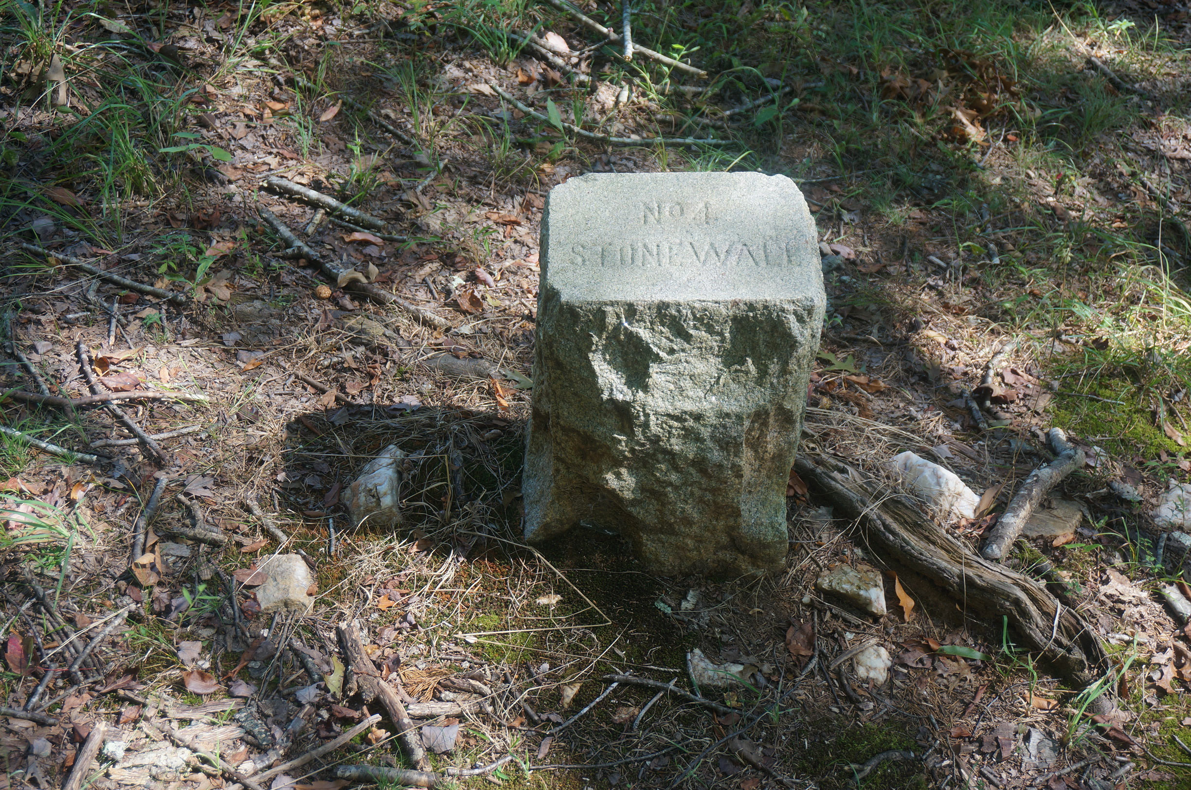
Marker #7 (formerly #5) is titled “The Battlefield Since 1862.” We call this location of the battlefield, “the Point.” Several of the original stone brigade markers which were placed about the battlefield by Judge Daniel Amon Grimsley of Culpeper in the early 1900’s have been brought to this location for protection. Grimsley was a veteran of the 6th Virginia Cavalry. His other markers can be seen scattered about the field in their original locations. The original placements were sometimes a nuisance to local farmers when equipment became mechanized, so they received the proper permission to remove them. We know of 4 original markers that are off-site, on private property, still in their original locations or close to it. Some have disappeared over the years.
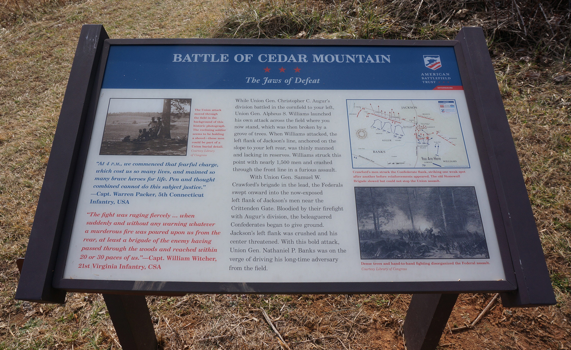
Marker #8 is titled “The Jaws of Defeat.” This marker places the visitor in the footsteps of the men of Brigadier-General Samuel W. Crawford’s three regiments who made an astonishing advance upon the left flank of General Thomas “Stonewall” Jackson’s first line. The terrain features here make plain the reason the blow came as such a surprise to the rest of Jackson’s line along the original Culpeper-Orange Road. A good example of some of the improvements made to the interpretive markers is reflected on the map on this wayside. It has been changed to reflect the forces of the 46th PA, which split during their attack.
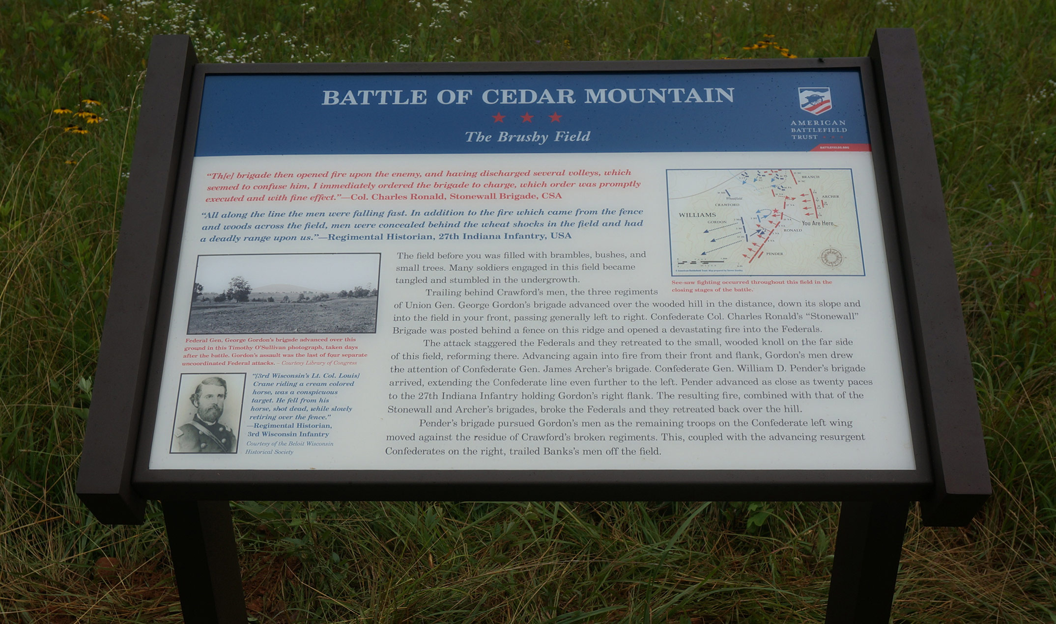
I am very happy to report that there is now a new interpretive marker on the ground titled, “The Brushy Field.” Previously this part of the battlefield action went uninterpreted. As Union General George Gordon’s troops arrived at the scene of battle, in support of Crawford’s attack, Confederate re-inforcements began pouring onto the field. The Union charge was stopped in its tracks, but still put up a bitter resistance. From here, visitors have a choice whether to continue north along the ridge to see the Stonewall Brigade Grimsley marker, and further on, the large monument to the 3rd Wisconsin Infantry, or to turn back and follow the trail back towards the Crittenden Gate to see the last interpretive marker, “Stonewall is with you!”
See our post on the battlefield monuments for more information.
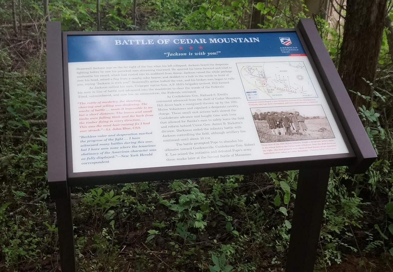
Marker #10, now in its new location, tells the famous story of “Stonewall” Jackson rallying elements of his broken line with General A. P. Hill’s troops just arriving on the field. The timely arrival brought the Confederates a stunning victory. This marker has been moved to a location on the preserved battlefield much closer to where it is presumed to have happened. The exact spot is unknown.
This gives an overview of what a tour can be; however, there are several other trails available, and guests can naturally follow any paths they prefer. Estimated time touring the battlefield on one’s own is up to 1 ½ hours.